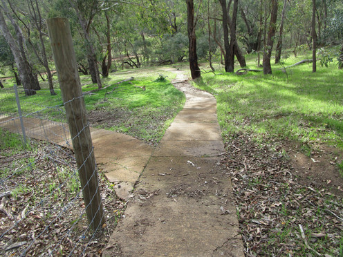
Armadale Settlers Common was proclaimed a reserve in 1897 after years of logging. It served as a commonage on which people could cut timber and graze animals. It is now a recreational reserve with many walking trails winding through the main section and the eastern section.
On our first visit to Settlers Common in June we headed to the Triton Close entrance off Albany Highway. We picked up a brochure on the outside of the Field Study Centre but even so we couldn't locate an obvious trail head for the Ngangangarra Trail which leads to the Yongah View Lookout. We couldn't see any other obvious trails either so followed the paved path towards Winter Creek before returning to the car to drive along Canns Road to Settlers Common East, parking on Observation Circle, which has expansive city views.

This is more like it! There are information signs, trail markers and paved paths. Short on time we decided to just walk the paved trail which took 20 minutes. In June there were limited wildflowers out so we put this on our list for a return in Spring.


We returned to explore more trails in September. Starting from Observation Circle this time we headed west along Coppice Trail, nearly stepping on a well camouflaged bobtail! This reminded us that it was also snake season and as the flat trails are covered in leaf litter we remained vigilant.
From the Coppice Trial we followed the Sawtooth Trail as it skirts properties on the edge of the reserve. There were lots of hibbertias and some fanflowers and leschenaultia along with a red flower that we could not put a name to.
We decided to continue along the Sawtooth Trail to the Port Hole Trail which has a view but we didn't find an obvious lookout or a view – perhaps we were walking in the wrong direction and it was behind us. This trail meets back up with the Sawtooth Trail before we turned left along the Stellata Trail. Instead of crossing Canns Road we took a smaller side trail running adjacent to Canns Road until we hit the Bandin Trail. We followed this trail, backtracking a short distance on the Sawtooth Trail before turning on to the Snotty Gobble Trail. This trail intersects the paved Baliff Trail heading west . After a short stint on the Golden Whistler Trail we followed the Jeeriji Trail back to the car. Yes there are a lot of trail names!
Once we hit the paved path there were more wildflowers so if we came again we would probably only walk the shorter paved walk.
This was a bit of a slog - on the alert for reptiles and not seeing much variety in scenery or wildflowers we considered this 60 minute walk to be a bit underwhelming. My preference as a hike would be nearby Bungendore Park. where we hiked the 1.7km Cockatoo Circuit and the 7.7km Honeyeater Hike.
If you are after a pleasant stroll through bush this will fit the bill and the paved path has a great deal to offer in the way of wildflowers and information. The bush trails have a number of dieback stations to cleanse your shoes as you move from dieback infested to dieback clear areas. The trails are all clearly marked but it was an advantage to have the detailed map we picked up from the Field Study Centre at Triton Close in June as an overview of how the trails connect.
There are picnic benches near Observation Close but no barbecues and no toilets and limited street parking,

Blue Trails - June walks. Orange Trail - September walk.

This area is a fruit growing area so if you are in the area check if there are any orchards open to buy seasonal fruit. On our June visit we called in to Waterwheel Persimmon Orchard and although harvest was over we were able to buy some delicious persimmons.

To read more blogs go to:
I love wandering along trails, both marked and unmarked, and sharing my discoveries with my Out and About FNC community. If you enjoy reading my blogs please consider a small donation which will be used towards the costs of keeping the website up to date and relevant.

In the spirit of reconciliation Out and About- Family Nature Connection acknowledges the traditional owners of the Wadjak boodjar (Perth land) and their connections to land, sea and community. We pay our respect to their elders past and present and emerging and extend that respect to all Aboriginal and Torres Strait Islander peoples today.
As always when hiking in the bush please help to reduce the spread of Phytophthora Dieback by sticking to the tracks and paths, staying out of quarantined areas and, if possible, clean your shoes before and after hiking. A spray of 70% methylated spirit and 30% water can be effective.


Comments